Walking the Edge of a Volcano: Hiking Imerovigli to Oia in Santorini
The Short Version
- Imerovigli sits at 350 meters elevation — the highest point on Santorini's caldera rim and the real starting point for anyone serious about the hike to Oia.
- Skaros Rock, a volcanic fortress established by the Byzantines in the 13th century, was never conquered by force in its entire 600-year history before earthquakes and a nearby eruption finally drove residents out.
- Once Imerovigli fades behind you, the cobblestone promenade ends and a raw dirt trail begins — that's the exact moment this stops being a tourist stroll and starts being a real hike.
- The elevation drop alone tells the story: Imerovigli at 350 meters, Fira at 270, and Oia at just 130 — every meter of descent is felt in the legs and rewarded in the views.
- Arriving in Oia on foot after miles of exposed volcanic ridge makes the blue domes and windmills feel genuinely earned in a way no bus or taxi ever could.
The Crowds of Fira and the Start in Imerovigli

The Crowds of Fira and the Start in Imerovigli
There's a particular kind of madness that grips you when you decide to hike along the rim of an ancient caldera in the Greek summer sun. We caught that madness, and we have no regrets.
We started in Imerovigli — the highest point on the caldera rim, sitting at 350 meters elevation, and the village that serious hikers know as the true sweet spot for the trail to Oia. The unofficial trailhead sits at a T-intersection: north to Oia, south to Fira, and west to the brooding mass of Skaros Rock. We arrived to find the cobblestone promenade already alive with tourists streaming past the white-arched arcade below — crowds flowing along the ancient stones, cruise-ship passengers and backpackers and honeymooners all funneled into the same gorgeous bottleneck.
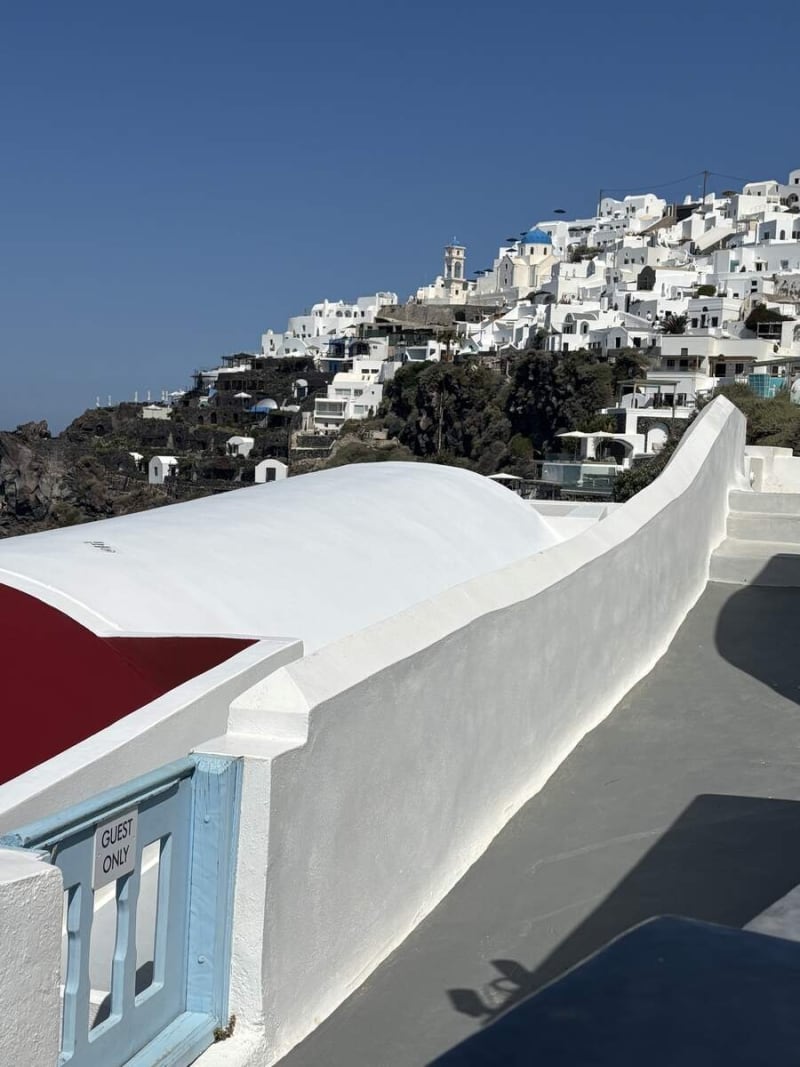
From our perch in Imerovigli, the village climbs the caldera in an impossible cascade of white cubes, blue domes and terraces. A "Guest Only" gate guards the edge of a whitewashed rooftop — beyond it, everything is views, pools, and the sheer vertical drop to the sea. According to multiple hiking guides, the path through Imerovigli is cobblestone and easy to walk, passing hotels, pools, and restaurants. Easy is a relative term when the caldera is dropping a thousand feet to your left.
What does it feel like to stand at the edge of something this old and this violent and this beautiful, and simply decide to walk along it?
Imerovigli: Village at the Rim
Imerovigli: Village at the Rim

Before heading north toward Oia, we made the mandatory detour west to Skaros Rock — and it was the best decision of the day.
Skaros Rock is the massive, rugged promontory jutting into the caldera just below Imerovigli, forged by volcanic activity — likely an eruption dated to 68,000 B.C. — and reshaped by centuries of erosion and earthquakes. From above, the full drama is visible: the flat-topped volcanic tower, ruined foundations clinging to its flanks, a narrow trail winding up its spine, the deep blue caldera stretching beyond toward the island of Thirasia.
Established in the 13th century by the Byzantines and later fortified by the Venetians, the Kastro of Skaros was an impregnable fortress designed to protect the population from relentless pirate raids. At its peak, a dense settlement of roughly 200 homes, businesses, and numerous churches clung to the rock. Because of its sheer cliffs and strategic elevation, it was never conquered by force in its 600-year history.

The selfie on the rocky Skaros path says it all — volcanic boulders behind, the caldera cliffs and white village of Imerovigli in the hazy distance, pure joy on our faces. That joy is earned.
The decline of Skaros began in the 17th and 18th centuries due to violent earthquakes and the eruption of the underwater volcano Kolumbo. Large sections of the settlement collapsed into the sea. Fearing further destruction, the residents eventually abandoned the rock, relocating to the safer ground of Fira and Imerovigli. What remains today is a ghostly spine of ruined foundations and wind — and one of the most extraordinary views in the Aegean.

Leaving the Villages Behind

Leaving the Villages Behind
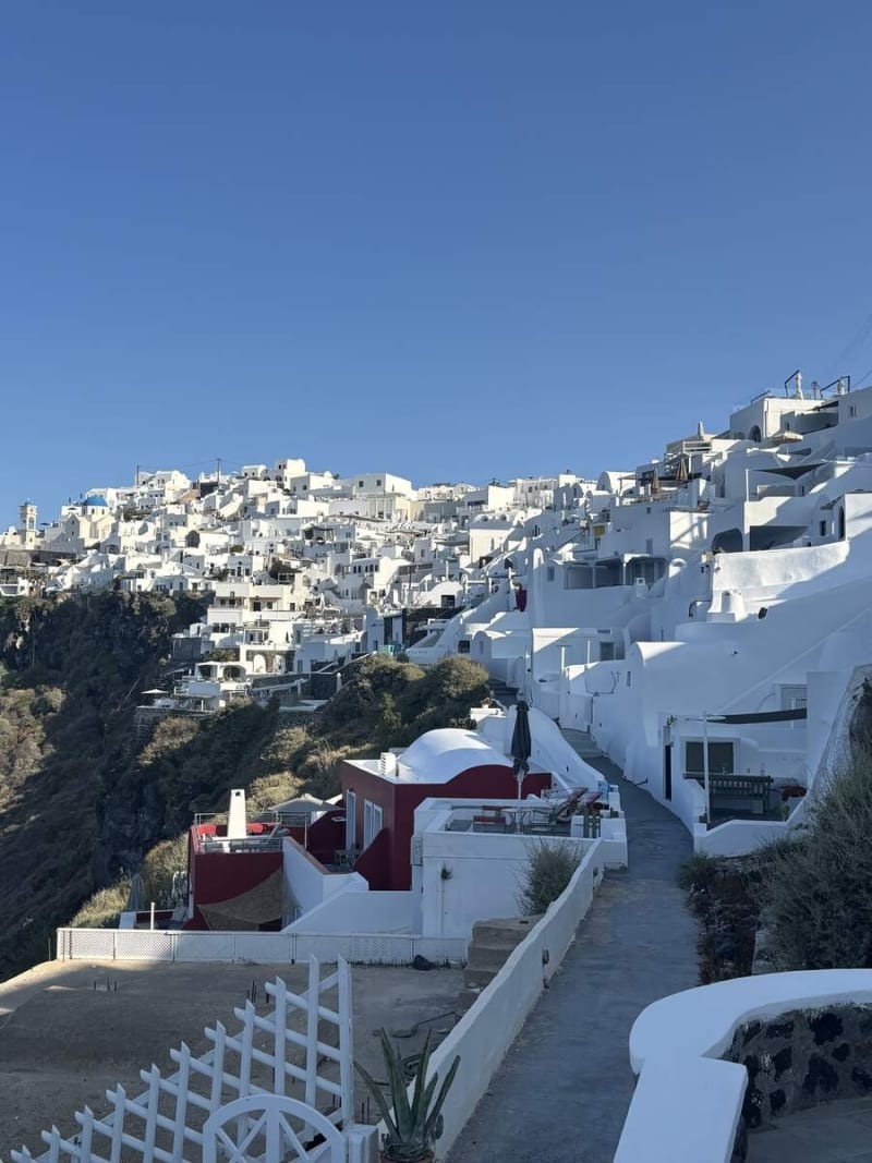
Back on the main trail heading north, the character of the hike changes completely once Imerovigli fades behind you. As you leave Imerovigli, the whitewashed buildings fade out, and the cobblestone walkway shifts into a dirt trail. This is where it starts to feel like a real hike — not a stroll between cafes.
Two hikers ahead on a cobblestone path flanked by a traditional stone wall — the caldera dropping away to the left, the dark volcanic cliffs extending into the distance. A small whitewashed chapel peeks over the wall to the right. This is what the trail looks like when it's yours: ancient, quiet, and impossibly beautiful.
Looking back toward Fira, a restaurant terrace perches dramatically on the caldera edge, the town gleaming white across the bay with the island's volcanic spine behind it. From up here you can truly appreciate the scale — Imerovigli sits at the high point at 350 meters, Fira at 270, and Oia at just 130 meters. You feel every one of those meters.
What does it mean when a path stops being infrastructure and starts being landscape? Somewhere between Imerovigli and the first hill, that shift happens.
The Wild Middle: No Shade, No Shortcuts

The Wild Middle: No Shade, No Shortcuts
As the cobbled walkways turn into narrow, dusty paths, there is no shade and not many refreshment options on this second half. That's not a warning — it's a feature. The exposure is the point.

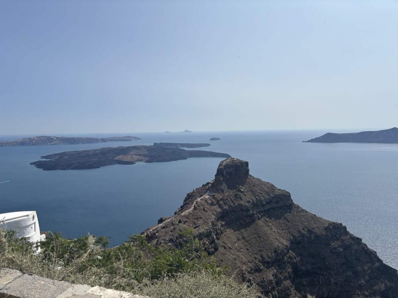
The views from the exposed ridge open into something almost geological — the sweeping arc of cliffs, the deep inlet of dark water, a cruise ship tiny in the distance, white houses barely visible on the far rim. There were long stretches where all we could see were the cliffsides ahead and Oia way out at the end of the island. The full panoramic scale of Santorini's caldera laid out like a map beneath you.

A welcome trail marker appears sporadically: a small terracotta-pink chapel with a white cross on a rocky outcrop, a woman in hiking gear passing it with purpose. These tiny roadside churches appear at intervals all along the route — some Cycladic white, some painted in warm earthy tones, all utterly serene against the volcanic landscape.
And then: perhaps the most charming navigation aid in all of hiking.

"OIA →" spray-painted on a boulder under a windswept pine tree. Primitive, perfect, unmistakable. The trail gives you exactly what you need and nothing more.
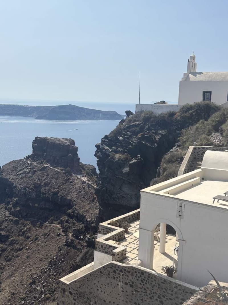
Profitis Ilias and the Final Push

Profitis Ilias and the Final Push
The trail rises toward the Church of Profitis Ilias — the last landmark before the descent into Oia. Just before the church the path forks: stay left to continue up for amazing views of the caldera, or go right for an easier walk that misses the views entirely. We went left. Obviously.

The caldera edge near the trail's high point — a white chapel perched on the rim, the island of Thirasia across the water. This is the moment the whole hike has been building toward. Oia is no longer a white speck in the hazy distance. It is right there.

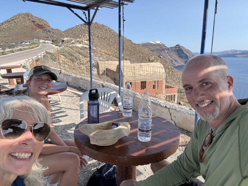
A mid-hike water stop at a roadside café — three of us around a table, water bottles lined up on a simple terrace, the volcanic hillside road visible behind, the caldera glinting in the background. No frills. Perfect timing. the best water I have ever tasted was from a plastic bottle at a concrete table above the Aegean Sea.
What gifts has a trail given you that you haven't fully named yet?
Arriving in Oia
Arriving in Oia
The trail eventually enters a parking lot before emerging on a pedestrian walking path. It is not until you reach the far western part of Oia that you see the iconic blue domes and windmills. Arriving on foot, after miles of volcanic trail, makes it feel genuinely earned in a way that stepping off a bus never could.
The Church of Panagia Platsani greets you first — brilliant white walls, blue dome blazing against the sky, a Greek flag flying proud, the bell tower rising to the left. Panagia Platsani was originally built inside the Oia castle, but due to the destructive 1956 earthquake, the church had to be rebuilt to the center of the village. The Anastasi Church nearby was constructed in 1865 and is dedicated to the Resurrection of Jesus Christ; Agios Spyridon, just 10 meters away, was built in 1867 and boasts a matching blue dome.
The view that appears in every travel magazine — a resort pool carved into the caldera cliff, white cave-house structures cascading below, a cruise ship on the deep blue sea. The windmills perched on the edge of the caldera were once used to grind grain using the island's strong Aegean winds; today they stand as symbols of Cycladic architecture, perfectly framing the sunset.

The last light fades and Oia lights up in gold and turquoise against a deep blue twilight sky. The caldera goes dark below, a pink glow still smoldering on the horizon. The village that was a white speck on distant cliffs when we started is now glowing all around us.
We took a taxi home — because some moments deserve a graceful exit.
Come find out what's waiting for you when you walk along that rim.
Content ID: vfUjc37tZCiJAFoG6dSm2LGG